Saturday, March 29, 2014

Kagel Mountain W6/CT-170


Activated Kagel Mountain on March 7, 2014.  I have been looking forward to this hike/activation as I have seen the hang gliders for years.  Views of the valley on the way up to Kagel Mountain. Started picking up wind the closer I got to the top.  It is just under 3 miles to the top via a fire road.


This small rise on top is a great place for you activation's.  There is a small bench, a picnic table, and a few trees.  I used a bungee cord to attach my "Jacklite" to the tree.


Notice the wind sock.  It was really blowing on top of the mountain.  I took cover to the left of the picnic table behind the small mound.  It offered some protection from the wind.  I should have brought some headphones, as it was difficult to hear the radio due to the noise caused by the heavy wind.


Hang gliders use this as a take off spot.


A reminder to hang glider pilots to hook in before they take off.  Good idea!

                                       
Roxy is my hiking and SOTA partner.  Over her right shoulder in the center of the mountains in the background is Fernando 2 Benchmark, W6/CT-158.


Roxy taking a rest on one of the hang glider pads while I work 20m.  Made a total of 21 contacts including S2S on 2m with KB6CIO (Bob) and WN6E (Martin) who were on W6/CT-226 and N6JZT (Hal) who was on W6/CT-034.  Thank you chasers!

Friday, March 28, 2014

Yerba Buena Ridge - W6/CT-163


I parked in the Oak Springs Picnic area.  It is nicely shaded, plenty of picnic benches and surprisingly, clean restrooms.  Be sure and display a forest adventure pass.  The gate to the picnic area was unlocked when I arrived at 0700 hrs.


Exit the parking lot and turn right on to Gold Springs Road.  Walk about 100 feet, crossing over a dry stream bed to the Oak Springs Trail.  Take the well marked Oak Springs Trail to the Forest Road.


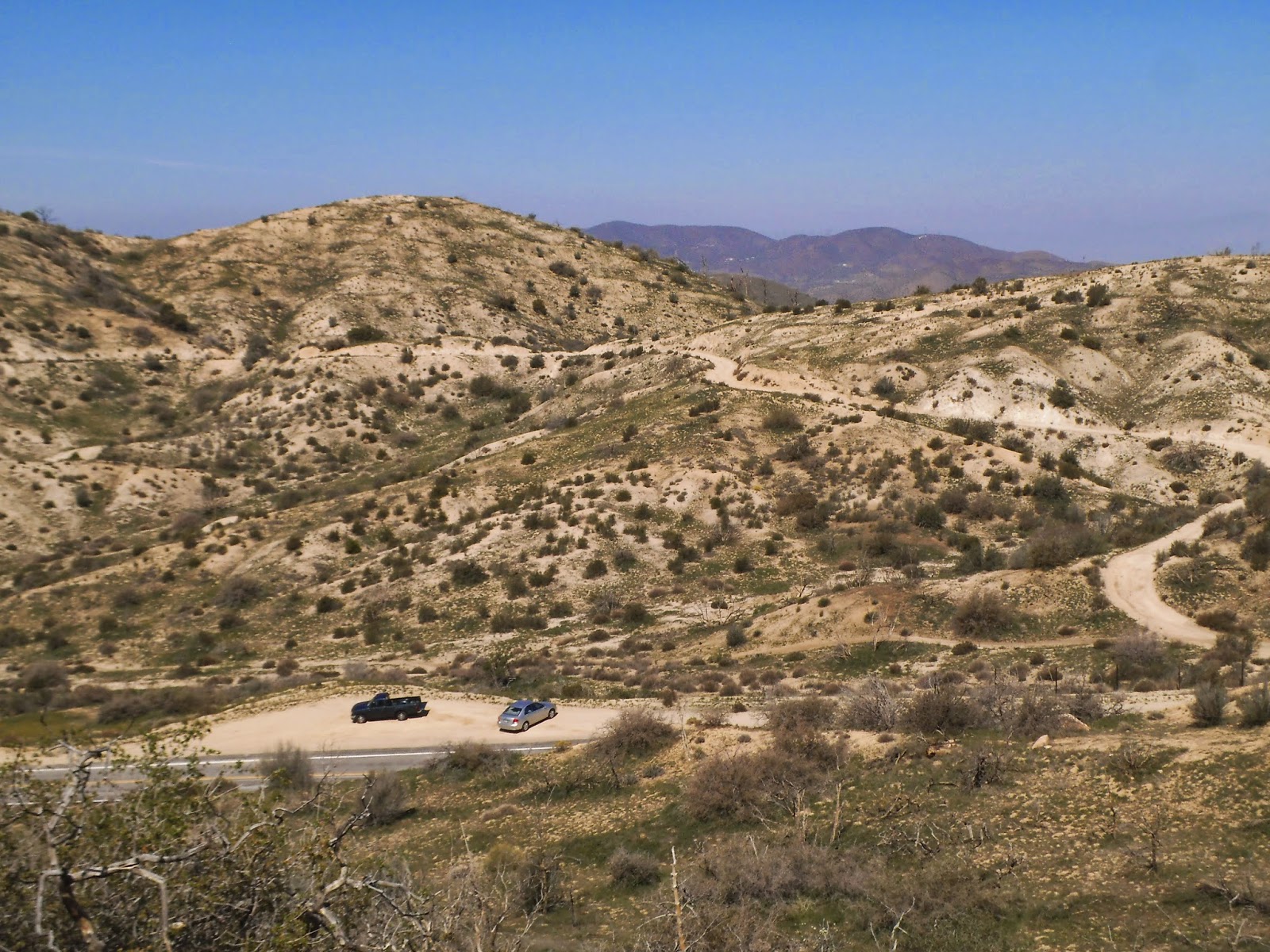
Like many trails on the west side of the Angeles National Forest, the trail quickly rises through a series of switchbacks.  This section of the trail is in good condition.  The picnic area is below.

 
Camp Karl Holton is visible from the switchbacks.  This is a juvenile hall style camp.


Here is the first view of Yerba Buena Ridge.  It is the rise in the middle of the photo.


The trail eventually tops a hill, showing the first view of the Pacoima area down below.  Unfortunately, it was slightly hazy today.


The trail drops into a valley with a nice approach to Oak Springs Trail Camp.  I was hoping to see some deer grazing this morning, but no luck.  I did see a nice covey of quail.


Oak Springs Trail Camp was really nice.  It would be great for a group of scouts on a training backpack. Not much water in the adjacent stream, but it was moving enough to provide water if one had a filter.


  The camp provides plenty of shade and a fire pit.


Arriving at Yerba Buena Road after 2.3 miles of hiking.  Turn left on the dirt road and follow it to Yerba Buena Ridge.


View of Angeles National Golf Course from Yerba Buena Road.


View of Verdugo Mountains, containing W6/CT-034.


Yerba Buena is the taller peak in the center of the photo.  The road is easy to follow and only a couple short, steep elevation gains.  Roxy still has a lot of energy.


I left the road and went for a short, easy cross country trek to the peak.  The peak is marked by this pile of rocks.  The coordinates for W6/CT-163 are below the peak.


The "Station Fire" rolled through here back in 2009, burning everything in it's path.  The area is made of grasses and short shrubs.  After a little hunting around, I found this lone, dead yucca tree.  It was perfect for my "Jacklite".  There were what looked like a couple small trees about 100 yards away that would have been suitable for the Jacklite and within the 80' vertical elevation of the activation point, but I knew the yucca would work well.


This is my 20m End Fed antenna attached to the Jacklite.  I have it sloping from North to South.  A lot of good, clear contacts today.

 
You can see by this photo that there was nothing to tie off the rope.  Thankfully I use hiking poles,  This was my 40m antenna.


Roxy, my SOTA hiking partner, is taking a well deserved break.  She slept during most of the activation's.  I had to pull a few ticks off of her when we got down the hill.  If you take this hike, be sure and check for ticks when the hike is complete.  With the low grasses and shrubs, there are a lot of ticks.


The mountain in the picture is Mt. Lukens, W6/CT-030.


Off in the distance is San Gabriel Peak W6/CT-019 and Occidental Peak W6/CT-098 as well as Mt. Wilson.


Roxy taking one last break on the way out near Oak Springs Trail Camp. There is a nearly 2100' elevation gain from the picnic area to the peak.  Most of the gain is on the trail to Yerba Buena Road.  I would caution against doing this trek in the summer when it is extremely hot in this area as there is no relief from the sun. The weather was perfect today. Clear with temperatures in the upper 50's and low 60's.  

I activated on 2m, 20m, 40m and 12m.  Thank you to all chasers and the spots today.  I had the following contacts:

2m - N6JZT, WA9STI

20m - K6TUY, NA6MG, NS7P, W0MNA, AB7YL, N6JZT, KF7JQV, W7CNL, WA2USA, KF5PMU, VE7KBN, AA7DK, K7NEW, KF7JDP, N6AKI

40m - WA9STI, N6JZT, KB6CIO, WA6RIC, W7RV, W7USA, K6EL, WN6E, WA6ARA, K6TUY, K6CMG, AA7DK, KB7HH

12m - N4EX, N6AKI, N6JZT, N7UN, W4MPS, KB1RJD, KB1RJC, KK1W, EA2LU, AJ5C, VA2VL, DJ5AV, KF5AIE

Summit to Summit with VA2VL on VE2/ML-002.

As I am still relatively new to HF and SOTA, thank you for your help and patience.  Thanks again to all chasers and those that spotted.


Friday, March 21, 2014

Mt. Emma W6/CT-029


I parked at a turn out on Mt. Emma Road between mile marker 1.86 and 2.19 on the North side of the road.  This photo is taken from the trail leading to Mt. Emma.


The trail is directly across the street from the parking turn out.  There is an Angeles National Forest boundary sign to the left of the trail.  Follow the trail up.


Boundary sign to the left of the trail head.


After nearly ten minutes on the trail, it intersects with an old fire road.  There is a pile of rocks at the intersection.  Turn left here and follow the fire road to the top.


This is a view from the pile of rocks.  Follow the fire road to the top of Mt. Emma, at the right of the photo.  Although only a mile in length, the trail gets quite steep with loose rocks in a few places.  Watch your step in the steep spots.


Roxy taking a break, waiting for the old guy to catch up.


At the summit, is a pile of rocks with the Summit Log.  It took me a total of 42 minutes to get to the top.


The Summit Log is in the canister.  Bob, KB6CIO, educated me earlier in the week on the summit logs as I thought the canisters were used for Geocaching.  I signed in and made an entry that I was on a SOTA adventure.


The Mt. Emma Benchmark is located next to the pile of rocks at the Summit Log.


I used this dead tree to support the "Jacklite" for my antenna.


I had the 20m antenna running North to South.  I had the other end tied off with some rope to another dead tree.


It took a few attempts to get this staged, action shot, of me working 20m.  I would set the timer on the camera and run to the radio.


View of Lake Palmdale down below.  There were some really good views of the AV and surrounding mountains from Mt. Emma.


The fire burned and killed all of the trees when it rolled across the mountain.  There are plenty of dead trees to support an antenna.  The tallest was probably the one I used to support my Jacklite, at about 15 feet or so.

I had a really good time walking around and exploring on top of Mt. Emma.  I am always amazed at how the terrain changes when a hot fire burns through.  The weather was perfect today with the temperatures in the low 60's and a slight breeze.  Made a Summit to Summit activation with Hal, N6JZT, who was on W6/CT-087.  If you decide to do this hike in the summer when it is hot, be careful, as there is not shade on this trek.

I had the following contacts on 20m:

AA7DK, W7OIL, W0MNA, NS7P, W7CNL, NA6MG, KA6AIL, K0YO, K7NEW, AA5CK, K9ZMD, AE5QB, KA5PVB, KD0VPR.  Thank you to all chasers!

Monday, March 17, 2014

Cerro Negro Benchmark - W6/CT-226


CT-226 is located off of a fire road.  It is under a half mile from the parking area to the activation point.  Just follow the fire road from the parking area to the antenna towers.


Here is a good view of the towers as you approach.  The benchmark is to the right of the trees in the photo.

  
Next to the benchmark is a bench you can sit on if you choose.  I attached my "Jacklite" to the tree (or was it a bush) on the left side of the photo and sloped my 20m End Fed antenna to the right.


Someone made a shrine of the benchmark.  Several locals walked past as I was on the peak.  I didn't want to be disrespectful, so I didn't take a photo of the marker.


I had minimal time for the activation, as I had to get ready for work.  I had eight contacts on 20m in a very short amount of time.  WN6E, N4EX, N4MJ, NA6MG, VE7KBN, N0EVH, NS7P, W0MNA. Thank you chasers!