
As I began to climb, I turned around and could see Mt. Islip, W6/CT-10, which I activated a couple weeks ago.

Here is my first look at Mt. Williamson as I climbed the steep trail.

Roxy was taking a break as she waited for me to catch up before climbing the final stretch to the top.


There is a pile of rocks that mark the summit. There should have been a summit log, but I couldn't find it. The actual peak is somewhat bare, but there are plenty of trees within the activation zone for an antenna. Before setting up, I had a Summit to Summit on 2m with N6JZT, Hal, and NA6MG, Dan, who were on Bare Mtn. W6/CT-082.


I found some nice trees for my antenna, which I ran from north to south across the summits.


As I settled in for the activation, Roxy settled in for her customary activation nap.


There are many nice views of surrounding mountains, including SOTA summits. The first picture is Kratka Ridge W6/CT-014. The second photo, I think. is Twin Peaks W6/CT-064 (may be incorrect on the mountain). The final picture is Waterman Mtn., W6/CT-012.


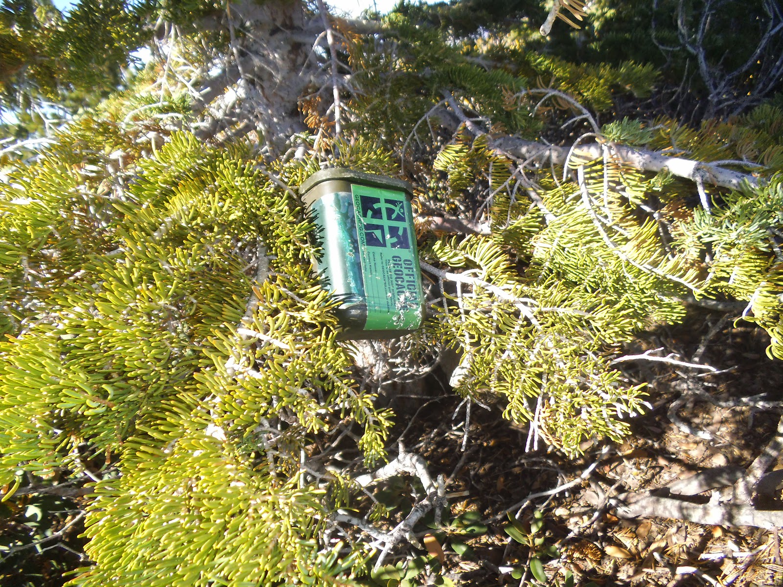
There is one geocache on the summit and another cache 1/4 mile away on the other Mt. Williamson.
I was hiking back from the second cache, approaching Mt. Williamson, when I thought I saw something out of the corner of my eye. I scanned the sky and saw a glider flying around Mt. Williamson and the surrounding valleys. Cool!


The trail down was much easier than going up. There is a section that is rocky. Use caution, as it would be a rough ride down if you slip.


I had contacts on 2m, 20m, 40m, and 12m. Two S2S on 2m and two contacts on 12m from British Columbia. Thank you to all chasers and spotters.
2m - N6JZT, NA6MG, KB6CIO
20m - W0MNA, NS7P, N6AKI, KI0SK, W7CNL, AE5B, K8LJG, K6EL
40m - W7RV, K6TUY, N6AKI, KN6CCW, WA6RIC, K6CMG, WB0USI, NK6A
12m - VA7ZOO, N6AKI, VE7XWA, W0ERI, KB1HXO, WB0TVY
No comments:
Post a Comment