Saturday, August 15, 2015

Pine Mtn W6/CT-040

I thought I would get up early and do an activation before the temperature in the Crescenta Valley rose above 100 degrees today.  I had scouted out Pine Mtn last year at this time and knew the gate at Guffy Campground would be open.  It was about an hour drive from my house over the Hwy 2 to the turnoff at  34° 22.336'N 117° 42.607'W.  Another option is to make the approach from Wrightwood.  I haven't made a blog entry in a while, as I had dropped and broken my previous camera on a hike.


After leaving Hwy 2, the road is a combination of torn up pavement and dirt.  There were some rough spots, but I had no problem with my 2 WD Toyota.  The road was in a little better condition last year when I scouted out the area.  The road goes through the Mt High ski runs and it is a fun drive. Arriving at Guffy Campground six miles later, the fire gate was closed.  I had not planned on that as I had driven to the trail head last year.  I parked on the road to Guffy about 100 yards from the fire gate.


While walking on the dirt road (3N06) from the gate, I had a good look at Pine Mtn


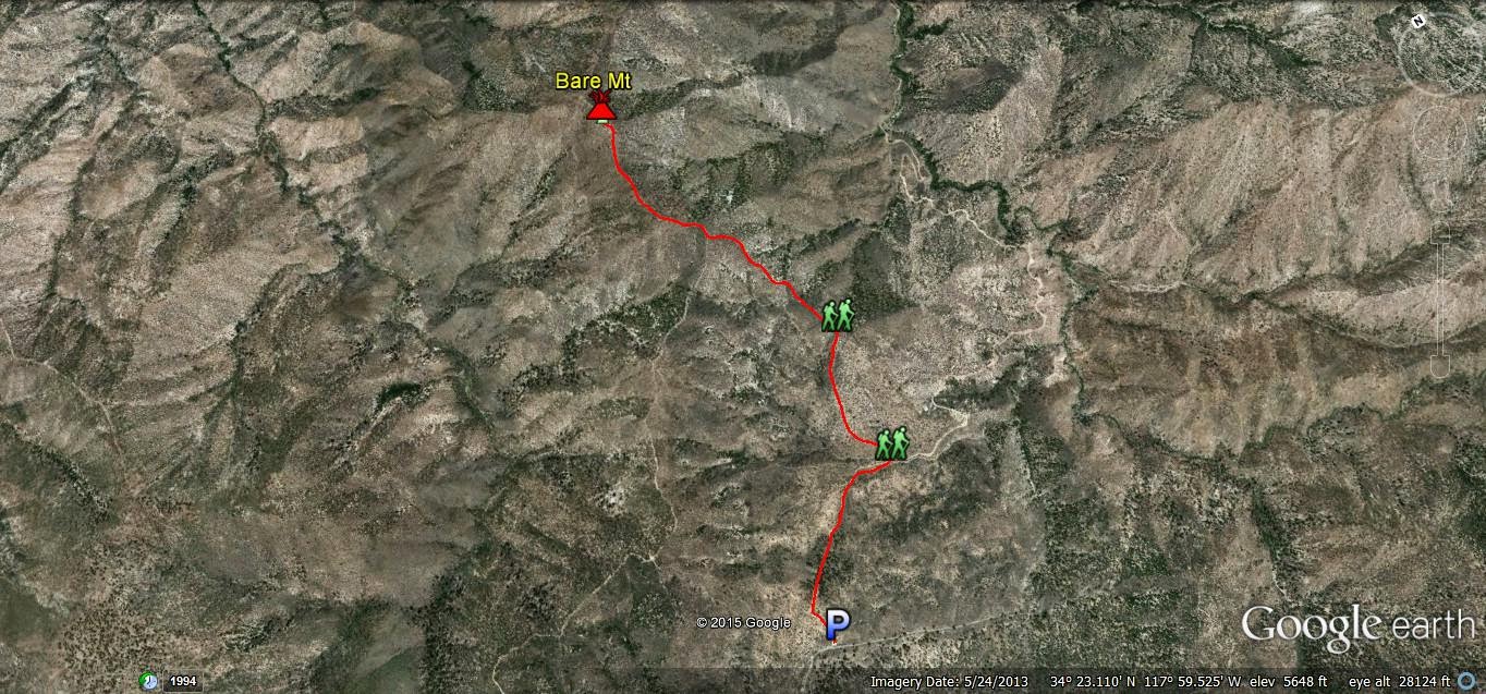
The locked gate was going to add two miles each way.  Fortunately, the temperature was in the upper 60's and it was a nice morning for a hike.  It took me 41 minutes to get to the trail head at   34° 19.754'N    117° 38.186'W.  Now the fun begins.  The trail drops and then follows the ridge to Pine Mtn, 1.28 miles away.  It was a steep trail, with loose gravel/rocks in places.  I am glad I did not take Roxy, as it would have been a difficult and dangerous hike for her.  Both sides of the ridge have steep slopes.


Walking the ridge, you can see the trail conditions and the steep slopes off of the trail.  I told myself when I get proficient with CW (which will be a while), I am going to buy a KX3.  I kept thinking how nice it would have been to already have that radio, as the weight is more than half the weight of my 857!  I better practice more so I can get that radio!


It was nice to get off the ridge and hike the steep trail in the trees.


At the summit, I took a break and enjoyed a cold "Powerade".  I found a downed log in the shade to set up my station.  Temperature was in the low 70's.  I had a contact with K6TUY on 40m, who said it was already very hot at the base of the San Gabriels.  I was able to spot via APRS.  I found out I had phone reception when I had a call from my son during the activation.  I was also able to spot via SMS.


I spent some time walking around the summit as I heard there was a "fort" up here.  I couldn't find it.  I did find the geocache, the summit log, and some cool chairs built out of rocks.


As the temperatures began to rise, it was time to pack up and start the tough hike back.  It was tough going down the steep ridge.  I am glad I had my hiking poles, as it would have been extremely difficult without them.  While walking the dirt road on the final stretch, I saw some movement in front of me.  It was a rattlesnake slithering across the road.  I stopped in my tracks, as I don't like rattlesnakes and was thankful Roxy was not with me as when I spotted the snake, it was about the same distance she walks in front of me.  As the snake went up the hill, I remembered I had a camera and snapped a shot.  I was going to wait until he got farther up the hill before I passed, but he began to turn back towards the road.  He was not happy when I decided to pass, giving out a loud rattle as his head went back and he began to coil.


As I was nearly back to the gate, I looked to my left and noticed a small fire, which I later learned was near Hwy 39.  As I approached the gate, I noticed that the gate was now open.  Bummer!  Next time I will call the ranger station and find out what time they open the gate.  I brought three pints of water and a power aide and drank them all.  Not sure of the temperature, but it was hot when I got back to the truck. I also saw a glider fly overhead while on the dirt road.


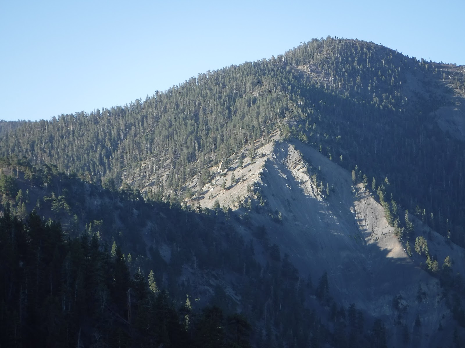
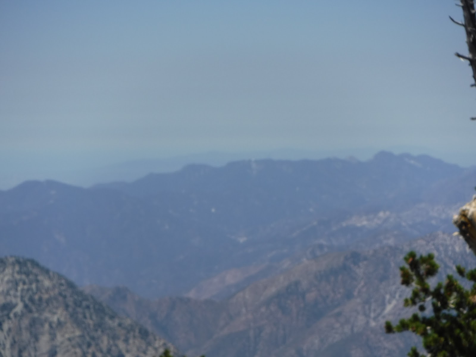
There were some nice views of surrounding mountains from the summit.


As a PAPA member, I was able to hit the club repeaters on Mt Wilson (PAPA 8) and Blue Ridge (PAPA 14).  It is nice to know in the event of an emergency, I can hit one of the repeaters from most summits in the San Gabriels.  While hiking up, I had conversations with fellow PAPA members and SOTA activators/chasers, Bob KB6CIO and Scott WA9STI.  Scott gave an outstanding SOTA presentation at last weeks PAPA breakfast.  It also inspired me to write a hiking plan that I left at the house should something happen on the hike.  PAPA 8 on Mt Wilson and PAPA 14 on Blue Ridge.


I brought three liters of water and 1 quart of Powerade, drinking all of them.  I ran out of water just as I was approaching the gate on the return trip, a short distance from the truck, where I had more water.  Had I known the gate would be closed, I would have brought more water.  All in all, this was an awesome hike with plenty of solitude and great views.  I recommend doing this hike in cool weather, have hiking/trekking poles, be in moderate shape, contact the ranger station to check on status of gate closure, and bring plenty of water.

While driving home, I decided to take a chance and drive the 2, hoping it wouldn't be closed due to the fire.  The other option would have been taking the 138 through Wrightwood to the 15 south.  A half hour of driving on the 2, I noticed that the fire had grown.


I made the following contacts:

2m - N6MIK, NA6MG (I could hear Charles, KM6CEM, but he couldn't hear me.  I spent about 20 minutes walking around the summit trying to contact him.  He is getting close to that 1000 point mark for chasing!)
10m - NK6A, KB6CIO
20m - AA7DK, K8TE, AE5B, W4DOW, VA7VJ, NS7P, K4JQV, W7RV, KD0MQV
40m - K6TUY

Thank you Chasers!!!!! 

Saturday, May 9, 2015

Grass Mtn W6/CT-130

Today marked my 50th activation with SOTA!  Thank you chasers!  After last week's hike to Smith Mtn., I felt a little guilty as although Roxy did fine on that hike, she could barely walk for the next three days.  I had read on Hal's (N6JZT) blog that Grass Mtn was  a drive up a fire road, so I thought I would give it a try.  It was just under an hour from my house to San Francisquito Cyn Rd and 6N04. There is a well marked sign at 6N04.  Turned left and followed the dirt road up for just under three miles to Grass Mtn.

  
I had no problem driving up the dirt road in my 2wd Toyota pickup, but I was a little concerned due to the rain the last couple days.  The road was in good shape.  I recommend anyone driving this road to go slow, as there are many blind turns and steep drop offs.  I came around one turn and nearly had a head on collision with three dirt bikes.


I was glad to see the gate was open (N 34 38.382 W 118 23.036).  I was even more relieved when it was open on the way back down.


I continued on the road to the fork (N 34 38.541 W 118 24.269).  Going right continues on 6N04. Left is 6N05.  I went left to the top.


The Pacific Crest Trail crosses the road.  On San Francisquito, I saw at least 15 PCT hikers today. They start in mid-April near the Mexican border.


I arrived at the top and set up the station.  This was the first time I brought a chair.


No need for the poles as there were plenty of trees for the antenna.


There were some nice views from the top.


There were two geocaches within a short distance from the top.


While I was doing the activation, Roxy found the shade from a nearby tree and took a break.

 
After working 20m and 40m ssb, I tried cw (slowly) on 20m.  Made a contact with Dan, NA6MG on W6/SD-068 for my first cw Summit to Summit.  I will continue to work at cw after the ssb activation.  If you contact me, please keep it at/below 10wpm with plenty of spacing, keeping the contact to call sign and signal report.

Thank you chasers for the contacts today!

20m - VA7JML, KA5PVB, NS7P, W0ERI, W0MNA, W7CNL, K8TE, WA2USA, W5ODS, W5MRM. W0CP

20m-cw- NA6MG (Summit to Summit)

40m - W7RV, K6TUY

Sunday, May 3, 2015

Smith Mtn. W6/CT-120

It was under an hour drive from my house to the trail head of Smith Mtn.  Take Azusa Ave (Hwy 39) north from the 210 fwy to the large turnout on the left side of the road.  It is three miles to the saddle and under a half mile from the saddle to the summit.  It took me 1:15 to reach the saddle and an hour from the saddle to the top.  It was a warm day and I had skipped dinner the night before as well as having only three hours sleep before the hike.  I was tired before I started and i really struggled on this hike.


There is a large parking area with restrooms ( N 34 17.244 W 117 50.560 ).  Smith Mtn is seen in the background above my truck.


The trail starts behind the restroom and is a gradual climb to the saddle with an elevation gain of 900 ft over three miles.  This is a really nice hike with several views of Smith Mtn and the surrounding mountains on the way to the saddle.  The trail is in good shape. Roxy went ahead and waited for me in one of the few spots that had some shade.  The closer I got to the saddle, the steep Smith Mtn looked. 


We arrived at the saddle in 1 hr and 15 min ( N 34 17.192 W 117 51.723 ).  We took a nice break here, giving Roxy some water and I took off my fleece pullover as it was getting quite warm. 


I looked up at Smith Mtn and thought it didn't look very steep.  As we began to hike up the fire break, I was wrong, it was steep.  As we got near the top, the faint, but easy to follow trail, took us over several rocks.  Roxy did much better than I did over this part of the trail.  I had been concerned she would not be able to make it over the rocks.  It was an 800 ft elevation gain from the saddle to the peak.


Finally made it to the top and located the bench mark.  I took a long break before I set up the station. I just took off my pack and sat down when I heard Hal, N6JZT, on 2m over at Pacifico Mtn.  We made a Summit to Summit contact on 2m.  I also spoke with Charles, KM6CEM, on 2m.  Feeling a little rested, I set up that station at the bench mark.  


There were some nice views from the top down towards the saddle, the surrounding mountains, the trail head, and I got a good look at the trail I had been on.  As I activated, Roxy cooled off and took a nap in a bush.


After making some contacts on 20m ssb, I switched over to cw without spotting to get a little practice.  I was surprised when I heard Dan, NA6MG, respond for my first ever cw contact.  Thank you Dan for the contact at a speed I could understand.  I have been somewhat apprehensive to do a cw activation, as when I have listened, everyone is so fast.  I will keep practicing and hopefully improve.  I was really hot and tired from the hike up and headed down, not spending as much time for an activation as I had planned.

I made the following contacts.  Thank you chasers!

2m - N6JZT (Summit to Summit), KM6CEM

20m - NS7P, NK6A, NM5S, W0ERI, W2USA, NA6MG (cw)

40m - N6KZ, W7RV