
Parking for Mt. Lawlor is at Redbox, a nice drive up the Angeles Crest Highway. The hike is about 2.75 miles each way with an elevation gain of 1300'. For those that like to geocache, there are a few caches along the way, beginning at Redbox. I arrived at 6:20 am to get a jump on the heat. It took me two hours to get to the peak. That included ten minutes of time I spent retracing my steps when I thought I lost my GPS. After retracing my steps for about five minutes, I realized that the GPS had shifted across the chest strap on my backpack. DUH! I also spent 10-15 minutes on the way up searching for a geocache. That was too much time spent looking for the cache when it was probably burned up in the "Station Fire."


The trail begins across the street and a little north from Redbox. The beginning of the trail is well marked with a couple sign posts and directly behind you is a street sign indicating the distance to Glendale and Mt. Wilson. The trail was in excellent condition. I was the only one on the trail and it was an easy hike to the junction at 2.11 miles. In fact, the hike was so easy compared to others in the San Gabriel mountains, I was beginning to feel guilty about not bringing Roxy. She saw me loading up this morning and really wanted to go.


The junction offers some nice views of the surrounding area. I recent;y purchased the 16' "Black Widow" and I wanted to test it out today. It is a minimum of five pounds lighter than my Jackite. I noticed the lighter pack weight and I felt really good when I reached the junction. The .60 miles from the junction to the peak is a difficult hike with a a 725/ elevation gain, often climbing over rocks. Roxy would have struggled with this section of trail.

Although the area has shown some good recovery from the 2009 fire, there is plenty of evidence that a fire roared through here.

It felt good to see the top of the mountain, as I was tired from that last section of trail from the junction. Be sure and wear pants for this hike, as you walk through several patches of brush after the junction.

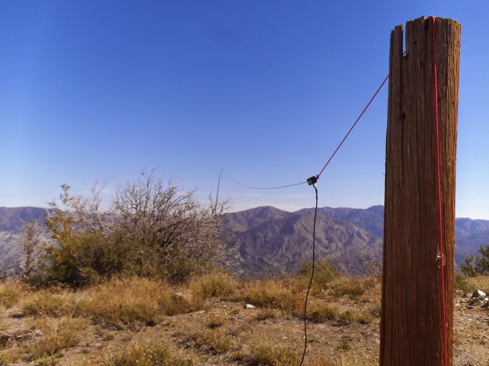

I have been using the 31' Jackite with good success. I wanted to try something lighter for a couple higher elevation treks I have planned, so I wasn't sure how the 16' "Black Widow" would work out. I tried something new and connected the insulator at the "Black Widow" and sloped the antenna with the matchbox about five feet above the ground. I wanted to test this to see if I could get by with less than the 50' of coax I pack. It worked out well and I had most signal reports in the 5/5 range. The added antenna length of the 40 meter appeared to not work out that well.

After I packed up, I realized I should have tossed some rope up in these trees and raise the matchbox end of the 40 meter antenna 25-30'.


After I finished with the activation, I looked around for the geocache. It was last seen in 2009 before the fire. The broken, porcelain disc is the only thing I could find at the geocache location. I speculate the cache was destroyed in the fire.

Mt. Lawlor offered several views of neighboring SOTA peaks. I liked this picture with Hoyt Mountain in the foreground and Mt. Lukens in the background. Both are SOTA peaks.

On the hike down, I had to share the trail with three mountain bikers. I was impressed they could ride on this narrow trail, as there is quite a drop off in some areas. I also came across three groups of hikers going up. They all said they were going to the more popular "Strawberry Peak."
A couple things I learned on this trip. First, is to bring more water water during the summer months. I finished my two pints with about 100 yards left on the trail (I had more in the car). Second, spend less time looking for the geocache on the way up. It cost me some time and energy on the way up stopping to check for the first geocache.
I had one Summit to Summit contact with KF5NBB from W5A/BR-002, Boat Mountain, in Arkansas. I had the following contacts:
2m - KN6CCW, WA9STI, N6JZT, AG6ZR
20m - N6KZ, N0OI, W0ERI, NS7P, W0MNA, WA9STI, W7FV, KF5NBB, W5RST, W5ODS
40m - KB6CIO
Thank you to all chasers and spotters!
No comments:
Post a Comment