Saturday, July 26, 2014

Throop Peak W6/CT-005


As the temperatures rose in the valleys below the Angeles National Forest, it was a great day for a hike to Throop Peak.  As I drove up Angeles Crest Highway, I passed Islip Saddle, I was contacted on Simplex by Hal, N6JZT, who said he could see Roxy in the bed of my Toyota pickup.  I made a U-turn and drove towards the lone car in the parking lot.  I have spoke with Hal on the radio, but never met him person.  As I drove towards the car, Hal said he was already on the trail.  I looked up and could see him a few hundred yards up the trail.  A quick wave and back on the Highway for a few miles to my parking spot at Dawson Saddle.


After parking, I crossed the street to the well visible trail.  Elevation at the trail head is just over 7900'.


The Boy Scouts did a great job on the Dawson Saddle Trail.  When my son was in scouts, we performed trail maintenance on many trails in the ANF.  The trail is in excellent condition and starts with a few switchbacks and gradually climbs to the saddle.  The trail meanders through pine trees, offering shade and some nice views.


At nearly two miles and 8900', I arrived at the junction with the Pacific Crest Trail.  Turning left takes you to Mt.Baden-Powell (W6/CT-004).  Turning right on the PCT will take you to another junction to Throop Peak. We took a short break before setting out on the PCT.


A very short distance on the PCT and you arrive at this fork in the trail.  Taking a right at the fork will take you to the top of Throop.  I was enjoying the hike on the PCT and missed the cutoff.  I had the Waypoint set on my GPS, but I inadvertently erased all the Waypoints when we started the hike and relied on my map to get to the top.  Missing the cutoff added nearly a 1/2 mile to the trek as I hiked around the Peak on the PCT. I ultimately left the trail and hiked to the top of Throop without a trail.


We arrived at the summit in 1:08 at a comfortable pace.  It is a nearly 1200' elevation gain from the parking area.  After a short break, I made a Summit to Summit activation on 2m with Hal, N6JZT, who was nearby on Mt.Islip, W6/CT-010.


I scouted the area for a while before finding a good activation location.  There was a good breeze going on the peek, so I wanted to find a spot that afforded a break from the wind.  These trees worked out great for the antenna and kneeling next to the log provided some shelter from the wind.  I ran my End Fedz antennas from North to South.


Not only did the log proved shelter from the wind, it made for a good bench for my equipment.            


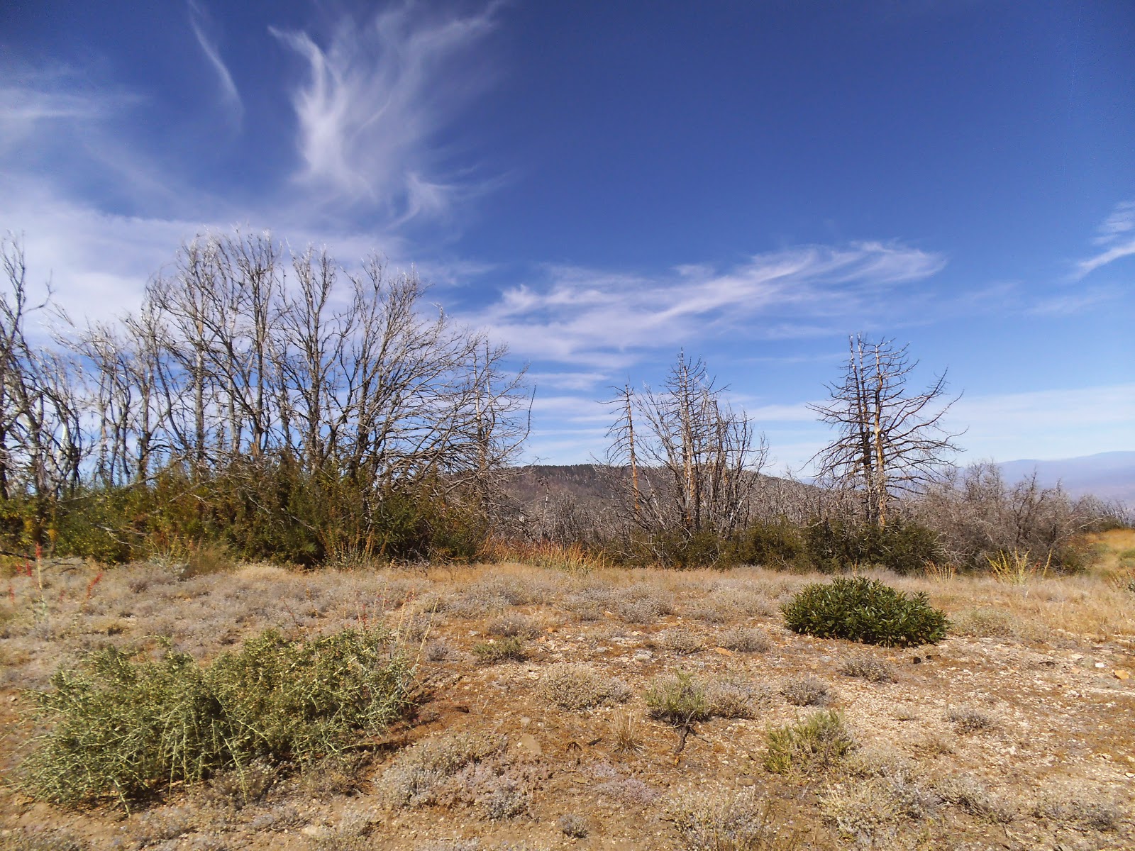
The peak provided some views of the surrounding mountains.


I packed up and headed down the mountain, finding the correct trail off of the peak.  It took about 45 minutes on the return trip.  Roxy was ready to go.  Shortly after we started the drive home, Hal got me on Simplex and we stopped for a quick meet and greet below Islip Saddle.  It was nice to meet someone I had spoke with several times on the radio and he provided some good suggestions for future treks.

There was a lot of noise on 20m, but made several contacts and four Summit to Summit contacts.  Below are my contacts.

Summit to Summit:  N6JZT/2m - Mt. Islip-W6/CT-010, WN6E/20m - Keller Pk - W6/CT-013, KB6CIO/20m - Keller Pk - W6/CT-013, N0OI/20m -  Onyx Pk - W6/CT-044, KY7S/20m - Big Muffin -  W7W/CW-075. KB6CIO/40m - Keller Pk. - W6/CT-013, KN6CCW/40m - Keller Pk. - W6/CT-013, WN6E/12m - Keller Pk. - W6/CT-013

2m - N6JZT, K6CMG,

20m - NS7P, WA2USA, AE9F, N4EX, KF6YGY, W0MNA, VE2JCW, AA7DK, W7CNL, N7AMA, N6MDV, WN6E, KB6CIO, N0OI, KY7S

40m - K6TUY, W7RV, KB6CIO, KN6CCW, NA6MG, WA6RIC. W7JET, AE9F

12m  - WB6L, WN6E


THANK YOU CHASERS, SPOTTERS, and S2S!!!

Monday, July 21, 2014

Pt. 6020 W6/CT-087


Earlier in the week, I was thinking about hiking up to Pacifico Mtn., but I thought I would take advantage of the cooler weather this week and decided to activate a peak that had a little lower elevation.  I chose Pt. 6020,  elevation 6020'.   Mt. Gleason Road has been closed since the "Station Fire" in 2009.  Rather than hike the 5 plus miles, I brought my bike to ride 5 miles on Mt. Gleason Road before cutting off on a dirt road for the last .31 miles.


I drove up Big Tujunga Canyon road to Angeles Forest Highway and parked at Mill Creek Summit, across the street from the entrance to Mt. Gleason Road.  At the summit, there is designated parking, restrooms, and a couple of picnic benches.


I had expected to have Mt. Gleason Road to myself, as it was a Friday.  I owned the road for about five minutes before the first water tender caused me to move off of the road.  I was passed by water tenders, semi-trucks, bulldozers, pick-ups, and even saw a few helicopters flying overhead. They were working on the electrical towers in the area.  With a conservative estimate, I would guess that I had to steer to the side and stop for over 40 vehicles.  I kept thinking I should have gone to Pacifico.  I would recommend staying away from this road Monday-Friday until they complete the project.  With all of the stops for the vehicles, it took me 1.5 hours to reach the dirt road cutoff at just over five miles.


These cranes passed me on the way up.  This is one of the projects they were working on.  One of the workers told me they were working at several locations along the road.

  
Another vehicle I had to share the road with.


The construction company had these accurate mileage markers posted every 1/2 mile, beginning at the first 1/2 mile mark from Angeles Forest Highway.  It was nice seeing the markers and knowing the exact distance I had to the cutoff to Pt. 6020.


At just over 5 miles I reached the dirt road cutoff to Pt. 6020.  I pushed the bike this final .31 miles as it was very steep and not in good condition.


There are several places in the activation zone to place an antenna.  The fire burned all the trees when it rolled through.  I found this open and flat area with plenty of trees for my antenna.


I sloped the antenna from North to South between the trees.  Everyone has their own way of putting rope in a tree to hang the antenna.  One person I know brings an old sock and fills it with dirt before tying it to the rope and throwing it over a branch.  I attached a couple screws with Super Glue to a small rock.  It doesn't add much weight to my pack and I bring it on my treks.


Some of the gear I brought up today.  Since I had the bike to carry the weight, I brought a few extra items than normal.  Yaesu 857, GPS, Kenwood D72a HT, rope, battery, coax, three End Fed antennas (12, 20, 40), Black Widow pole, and thermos of coffee.  I didn't need the pole due to the trees.  It was nice having some coffee during the activation while enjoying the views.


There were some nice views of surrounding mountains including  Mt. Gleason, Mt. Lukens, and Mt. Wilson.


I checked for some geocaches on the ride down Mt. Gleason Road as well as on Angeles Forest Highway.  Of the four on Mt Gleason Road, I found one.  The others appeared to have been burned in the fire.  On the drive home, my first geocahe stop was at Monte Cristo campground.  There are several shaded campsites, restrooms, and water.  Although I never camped here, I have rode my motorcycle here several times.

The next geocache stop was at Hidden Springs picnic area.  When my son was in Boy Scouts, we would park here and head out on backpacks to Falls Creek for some fun camping and fishing.  There is a cool looking tunnel going through the mountain.  Before the fire, DFG regularly planted trout in the stream below the picnic area.

My final geocache stop of the day was just below Hidden Springs.  I have driven by this old, stone "fort" structure several times, but had never stopped.  The geocache was in good shape and there was a nice view of the bridge below 

My activation included three Summit to Summits.  20m had some noise, but conditions on 40 and 12 were great.  I had cell service on this peak, so I was able to spot myself via SMS. I made the following contacts:

2m - WN6E, KB6CIO, K6KWI (All three S2S on Fernando Benchmark - W6/CT-158), N6JZT (S2S on Mt. Williamson - W6/CT-011), K6TW

20m - KA5PVB, N0OI, W7CNL, NS7P, W0MNA, WB6USB, K6TUY

40m - W7RV, WB0USI, K6EL (S2S Mt. Davidson - W6/NC-423), KN6CCW, W9LS, N0OI

12m - WA2USA (Great signal to Indiana), K6TUY, WN6E (S2S Fernando Benchmark)     

Thank you to all chasers!