Sunday, June 19, 2016

Mt. Emma W6/CT-029


I haven't been out for a SOTA activation in nearly two months, due to a crazy work schedule.  I finally set some time aside for Friday for a hike and SOTA activation.  I had activated Mt. Emma back in 2014, but forgot how steep the trail was.  It took me just over 45 minutes to get to the top, including a short stop at the two geocaches along the way.  It takes me about an hour from my house to get to the parking area on Mt. Emma Road at 34 27.990 N 118 04.830 W.  The trail climbs 1000' in under a mile.  I am not sure if I was breathing hard due to the steep trail or the fact that I have not been on a hike in two months!


Directly across from the parking turnout is the Mt. Emma Trail sign.  This is a nice, new addition since my last hike here.  Previously, it was difficult to find the trail.  When crossing Mt. Emma Road, watch for cars, as numerous commuters drive this road in the morning on their trek to Los Angeles as an alternative to the 14 freeway.   The trail is easy to follow all the way to the summit.


About a third of the way up, there is a pile of rocks on the right at a "T" intersection.  The trail connects with an old fire break at 34 27.868 N 118 04.690 W.  Turn left and follow the trail to the top. Mt. Emma is seen in the background.


I stopped for the two geocaches along the way to the top.  The first one was cool.  It was a piece of wood with the cache hidden inside.  The second was a camouflaged ammo can hidden inside of a bush.


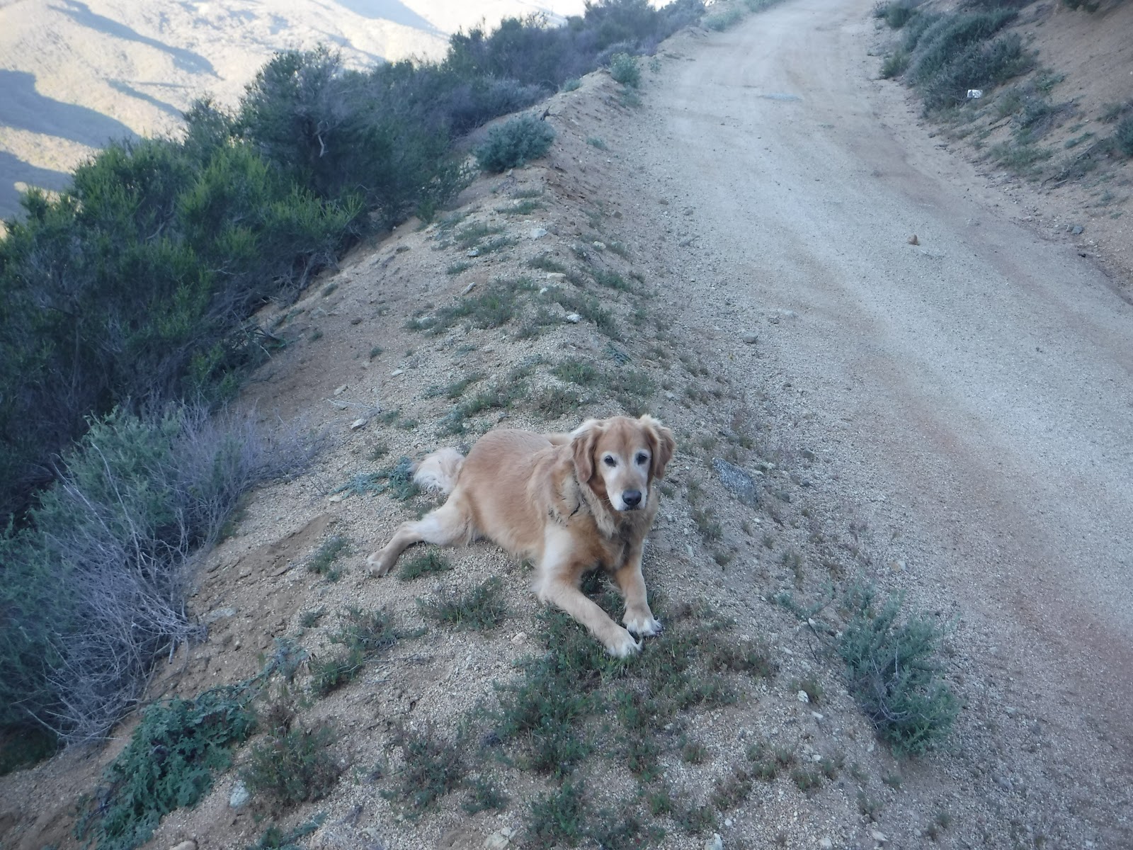
The trail is in decent shape and easy to follow.  Although Roxy and I are both getting older, she still runs ahead of me and waits for me to catch up.  I notice her recovery time after a hike is getting longer.  She still loves to hike, so I will keep taking her with me.


Arriving at the summit, I noticed someone had put up an American flag.  It was nice to see it waving in the breeze.  I also located the summit marker.  


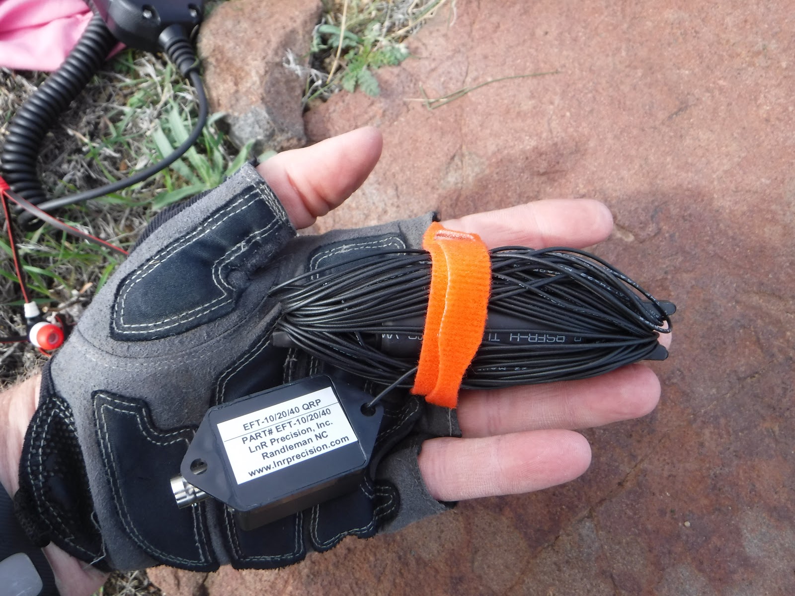
I ran the LNR "Trail Friendly" 10/20/40 antenna north to south.  I like the compact size of the antenna and it fits in the palm of my hand, taking up minimal space in my pack.  It is easy to deploy.


The last time I was here, I had my Yaesu 857 radio.  It was a nice radio, but heavy for hiking.  I really enjoy my KX3, both for the ease of operation as well as the lighter weight.  


I could see the smoke from the "Sherpa Fire" in Santa Barbara County.  This is definitely a cool weather hike, as there is no shade on the trail.  I was on the summit for an hour before it started to heat up to the 90's.  Bring plenty of water and always keep an eye out for the many rattlesnakes in the area.

I had the following contacts.  Thanks to David, N7SMT, from Washington for the spot.  Thank you to all chasers!


TimeCallBandModeNotes
15:22zNG6R28MHzSSBSouthern California
15:40zW0MNA14MHzSSBKansas
15:41zW0ERI14MHzSSBKansas
15:44zKG3W14MHzSSBPennsylvania
15:45zN4EX14MHzSSBNorth Carolina
15:49zN7SMT14MHzSSBWashington
15:50zWW7D14MHzSSBWashington
15:51zNS7P14MHzSSBOregon
15:53zN1CC14MHzSSBTexas
15:55zKF7JQV14MHzSSBWashington
15:56zK0BBL14MHzSSBWashington
15:58zN8OQ14MHzSSBVirginia
15:59zAF7MD14MHzSSBOregon
16:06zN7AME14MHzSSBWashington
16:08zKF7AXB14MHzSSBWashington
16:12zKB7XL7MHzSSBNevada
16:18zW7RV7MHzSSBArizona
16:19zKB6CIO7MHzSSBSouthern California
16:20zNA6MG7MHzSSBSouthern California
16:25zAA7DK7MHzSSBArizona


Friday, April 1, 2016

Granite Benchmark W6/CT-132

Took an early morning drive up the 14 fwy, exiting in Palmdale and drove to Bouquet Canyon Road. Parking is at the same location as Mt McDill W6/CT-118.  The hike up to Granite Benchmark is via a dirt road is four miles each way with a 970' elevation gain.


I scouted the area a couple weeks ago after activating Burn Benchmark.  When scouting the road, I was stopped at this water runoff rut.  I didn't want to chance it and I don't think I would have made it.  A 4wd vehicle would have no problem getting past this spot.  Had I been able to clear this spot in my 2wd Toyota, I could have made it to the turnout.  


I stopped for a couple of the geocaches along the way.


Roxy took a break while I located the geocache.


 At 34 35.858 N 118 19.808 W, you will come to a clearing off the dirt road.  Turn right and hike up the dirt power line road to Granite.  The distance from parking to the clearing is 2.77 miles.  From the clearing to the peak it is 1.21 miles.


After making a right at the clearing, walk past the gate and follow the power line road.  I could hear the lines "buzzing" the entire section of this hike.


The final approach to Granite is quite loud, due to the "buzzing" of the power lines overhead.  After walking past the metal giant, there is some light, easy bushwhacking to the summit.

  
When I got to the summit, Roxy was laying down next to one of two benchmarks on the summit.


On the summit, someone had put up two PVC poles.  Perfect spot to attach my pole.  I ran the antenna north to south.  I also attached the new J pole for 2m/440.


Conditions were bad due to the RFI from the nearby power lines.


There are some nice views of Bouquet Canyon Reservoir on the hike up.  Bee Benchmark W6/CT-169 is the peak above the reservoir on the left.


It took me 1.38 going up and about 1.20 going down the hill.  Always nice to see the truck at the trail head upon return.


Thank you chasers for staying with me with the heavy interference.

10m - NG6R

40m - AA7DK

20m - N7BHP. N4EX. WA2USA


Friday, March 11, 2016

PT. 3784 W6/CT-168

Easy drive from the house up the 210 to N/B 5 fwy, 14 fwy north, exit Sierra Hwy to Escondido Cyn Rd.   I grabbed a cup of coffee and headed out around 6am.  All the traffic was headed S/B towards Los Angeles.  I was listening to an audio book and next thing I knew, I was in Palmdale, missing my turn by about seven miles.  I made a U-turn at Palmdale Bl and headed back.

I thought I would try a different approach from what Dan and Hal took.  I didn't want to deal with anyone talking about trespassing on what should be public property.  I parked just over a mile east from where they entered.  The parking is at  34° 30.033'N 118° 13.919'W.  I followed the lower hills up to the ridge, about .75 miles with an elevation gain of 700".  There is no trail until I reached the ridge.  The last .25 mile to the ridge was steep.  It took me 40 minutes to complete the .75 mile to the ridge and about 5 minutes along the ridge for the last .25 mile to the summit.


The picture doesn't do justice to the last push to the ridge.  I was thinking I should have gone the way of Dan and Hal, talking to the lady about passing their property.  Roxy found some shade to wait for me.  I followed a couple animal trails up to the ridge.  It was warmer than I expected.


Once on the ridge, it is relatively flat to the summit, about .25 mile away.  As I was walking along the ridge, I began thinking the hike to the ridge wasn't too bad.  There is a nice trail that follows the ridge.


I came across the summit quickly.  It was a pile of rocks offering good views in all directions.
I stood on the rocks, looked west and thought that must be the route coming from the other direction.


I pulled out my antenna and noticed that the matchbox was disconnected.  I checked my pack and couldn't find the small pair of pliers I normally bring to make the repair.  Fortunately, I had recently purchased the LNR "Trail Friendly" antenna.  It is small and fit in the palm of my hand.  I 
had wanted to try it, so I guess now was the time.


When I went to set up the new antenna, I noticed the hole on the matchbox and the radiator that I normally attach rope for hanging the antenna, was much smaller and my rope would not fit.   I checked my pack for extra rope and surprise, I didn't have that either.  What a day!  I checked around the summit for some string and wouldn't you know it, I was on a summit with no trash.  I looked down, thinking what to do, when I noticed my shoelace.  It worked perfect!


I ran the antenna from north to south.


Roxy got some good rest while we were on the summit during the activation.


Nice views from the summit in all directions.  The first picture is Parker Mtn which I activated a while back.  The temperature suddenly dropped at least ten degrees and the wind started to pick up.  I could see the storm clouds moving in.  


 Always nice to see the truck on the way back down.  When I arrived, I noticed that CHP issued me a warning  for not parking more than 72 hours.  I guess it is time to get a new truck as he probably thought my 97 was abandoned.


 I worked 10, 20, and 40 meter bands today, making contacts all over the country.  A lot of QSB and noise.  Thank you chasers!

10m -  NE4TN, KG3W, N4EX, KI4AAU

20m - N7BHP, W0MNA, W0ERI, N8DEA, KF7JQV, K3JH, KB9AIT, NS7P, N1GB

40m - W7RV, KX6A, AA7DK, K6EL