
After parking, we loaded up and walked past the yellow gate, following the dirt road all the way up. At GPS coordinate 34° 27.138'N 118° 7.774'W, we came to an intersection and turned left. Going straight would have taken us to Angeles Forest Hwy, below Mt. Emma Road, about two miles away. I scouted the dirt road about two months ago near Angeles Forest Hwy. You can drive it from that location, but I felt uneasy, as I drove past some beat up mobile homes with "no trespassing" signs, feeling like I was in the movie "Deliverance."

As we walked past the numerous electrical towers that followed the road, I felt like I was listening to a Rice Krispies commercial as we constantly had the sound of "Snap, Crackle, Pop," from the wires above. Pt. 4460 is in the distance above the towers.

The road would have been impassible on foot during the work week due to the construction.


Below is the faint trail we took to shave off .18 miles on the way up and back.

As we rounded a bend in the road, we came across an "Andy Gump" porta-potty on the side of the road, with a steep drop off the side of the road.


The last 1/4 mile is steep, with no trail. We took our time, as I am always concerned about rattlesnakes in these areas.

Arriving on top, I could see the lone post, just as Hal, N6JZT, had reported from his activation. I used the post to attach the black widow pole.


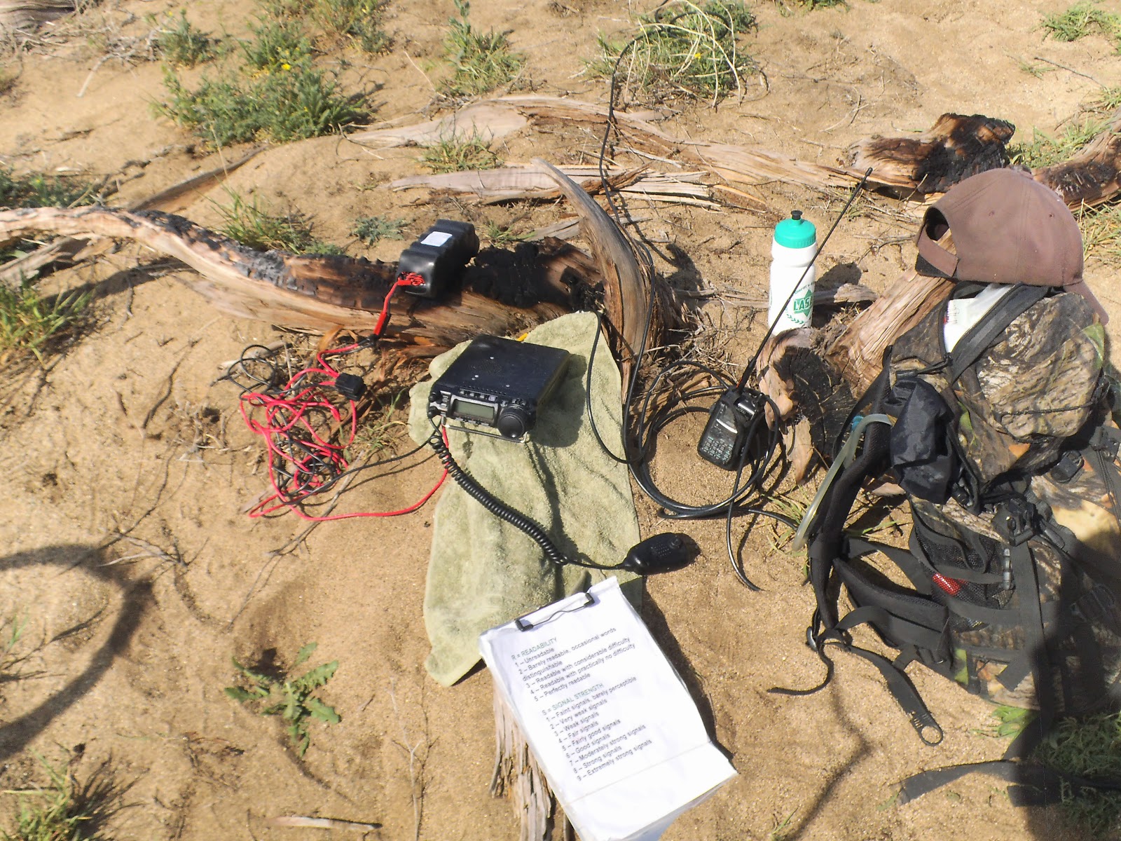
I found a good spot to set up my station with nice views in all directions.


Roxy wasn't too happy about my wife using her as a pillow as they both tried to take a nap.

View of Mt Emma W6/CT-029.

Parker Mtn W6/CT-153

Roxy took a swim break on the way back. The water was dirty, but she didn't care.

There was a lot of QSB on the bands today. I had a "Summit to Summit" activation with George, WB5USB, who was in New Mexico on Gray Hill, W5N/MG-033. Thank you to all chasers for the contacts!
10m - AE9Q, K4MF, KK4EUN, W3WGW
20m - W5ODS, W0MNA, K7KRS, WB5USB
40m - W7RV, NK6A, N6JZT, AA7DK, N6JT, K6TUY
No comments:
Post a Comment